 Your Privacy Choices
Welcome back to another installment of Friday Night Lights. If you recall I did a review of DJI’s Mavic 2 Enterprise Dual (M2ED). It is an entry-level thermal drone. It works but it is not very good. It is not that useful for flying at night and the thermal is only 160×120 resolution. Well DJI has the Mavic 2 Enterprise Advanced (M2EA) thermal drone and it is not only affordable but actually useful. Let’s check it out.
Thermal @ TFB:
- Friday Night Lights: Mavic 2 Enterprise Dual – Thermal Fusion Drone
- Friday Night Lights: Trijicon/BAE OASYS UTCXII – Long Range Thermal Clip-On
- Friday Night Lights: iRayUSA New RICO MK1 W/ Laser Range Finder
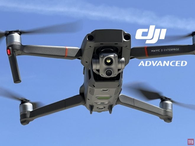
Mavic 2 Enterprise Advanced (M2EA)
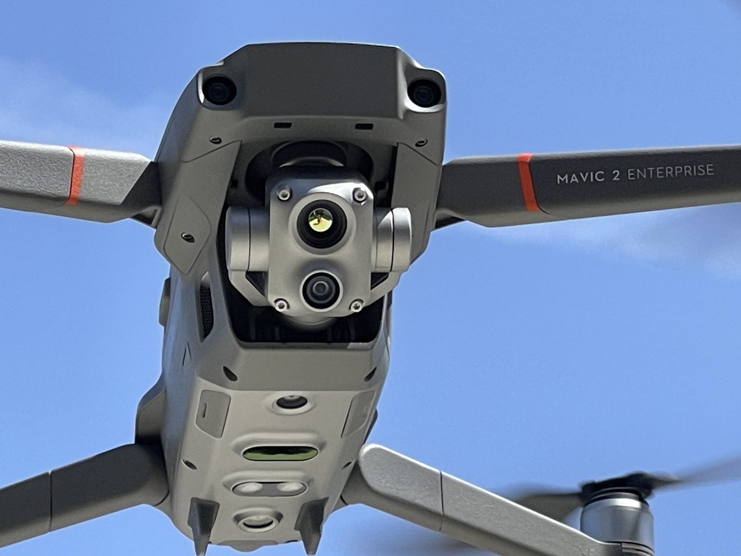
M2EA thermal payload
The old Mavic 2 Enterprise Dual was a collaboration with FLIR and DJI. While the M2ED worked as a thermal drone, it is like saying the FLIR ONE is a thermal camera. While technically they both are, they are not very good. Well, now you can get the M2EA instead. It has a thermal sensor that DJI made themselves. No FLIR parts here. It has a 640×512 thermal sensor! That is 16x bigger than the 160×120 sensor on the M2ED. The M2EA sensor suite also features a 48 MP visual camera. The M2ED only had a 12 MP camera.
The M2EA drone itself is virtually identical to the M2ED. In fact, I cannot discern a difference. It uses the same propellers, batteries and accessories. Flight times are similar. In some cases a minute or two apart from one another. The only real differences between the two is the price and performance of the sensor suite. The M2ED can be found for around $3,000-$3,500 since it is discontinued. The M2EA is relatively new and goes for $6,500.
Using The M2EA
The old M2ED was a collaboration with FLIR so it had some tools for thermal inspection use. The newer M2EA does not have these. Like isotherm. You can poke the image on the screen of your smartphone or smart controller and it will tell you the temperature. The M2EA photos and videos can be inputted into software on your computer to pull that information but it is not easy and not Mac-friendly. Another major difference is the loss of MSX mode. The M2ED would overlay the thermal image with the visual image to give you a fusion-like image. This is partly due to the low resolution of the thermal on the M2ED. But the M2EA has a great thermal camera that does not need to do this. So instead it does a split-screen or it just shows you the VIS camera or thermal camera.
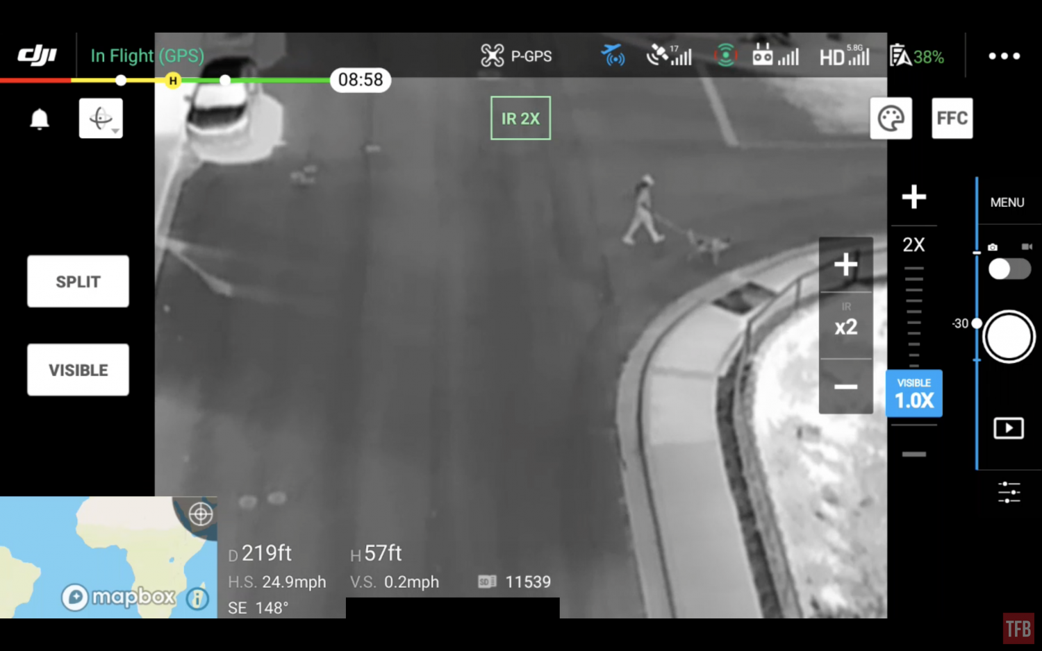
Screencap of the M2EA smart controller using thermal only.
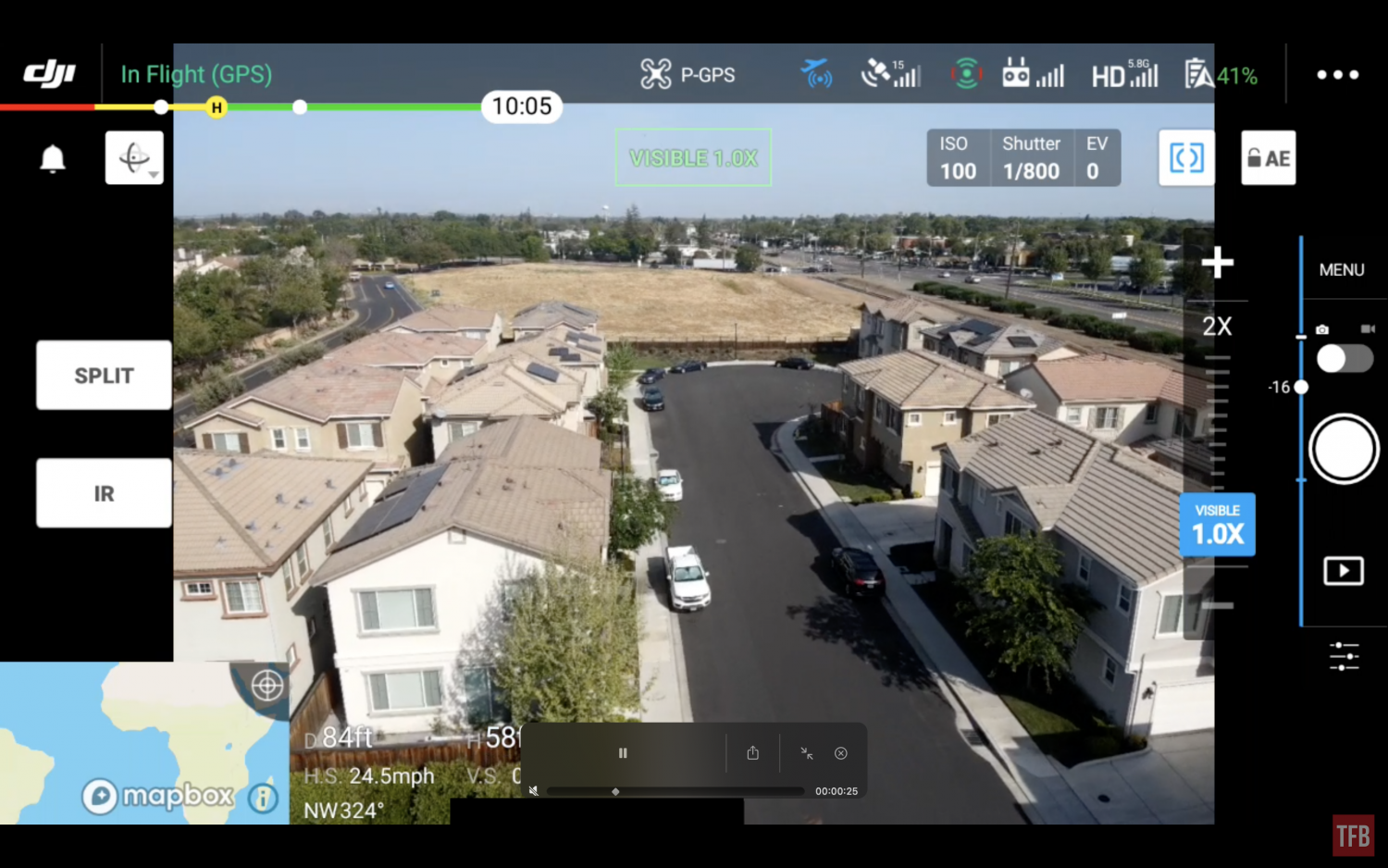
Screencap of the M2EA smart controller using VIS only.
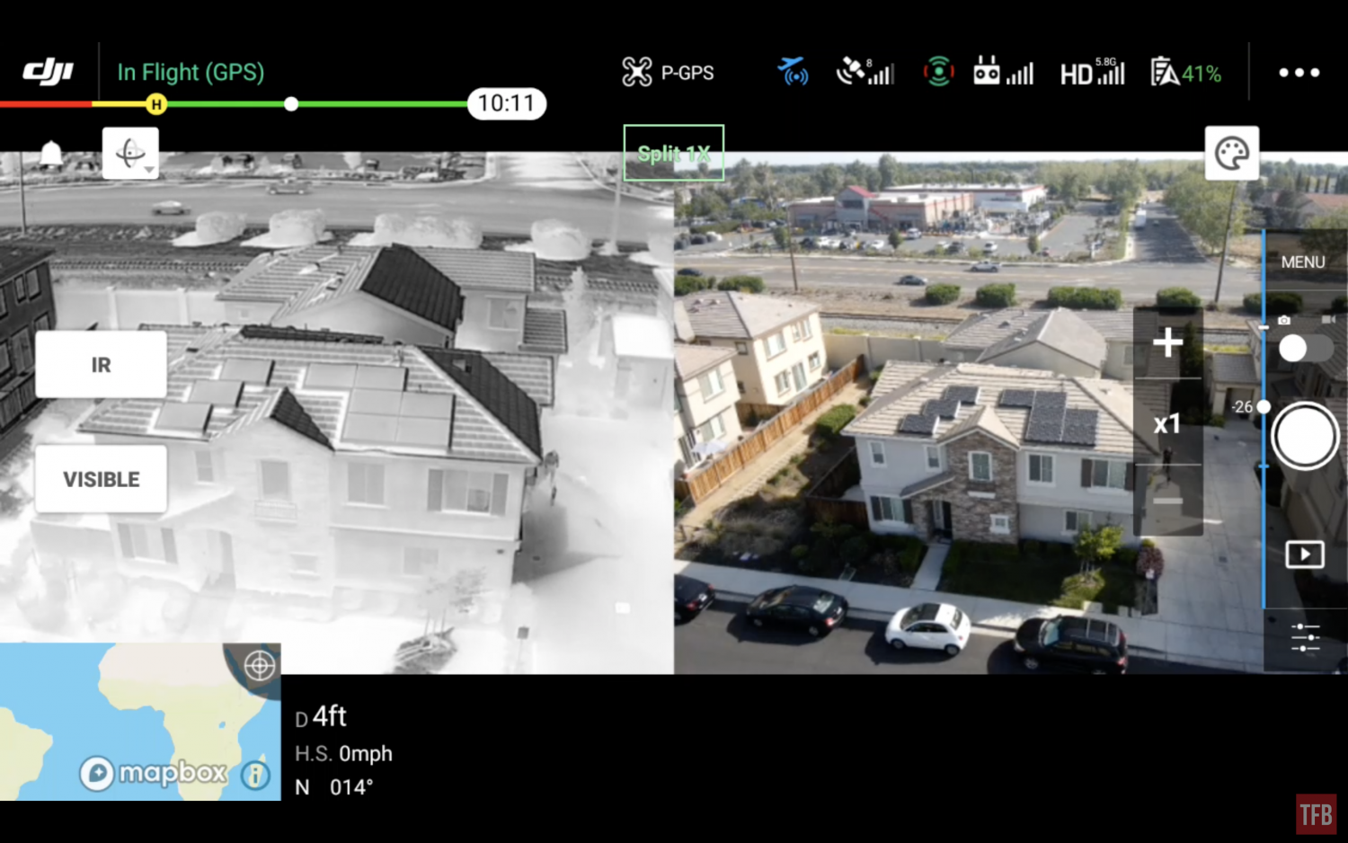
Screencap of the M2EA smart controller solid screen
99% of the time I fly using the thermal camera rather than the vis camera, especially at night.
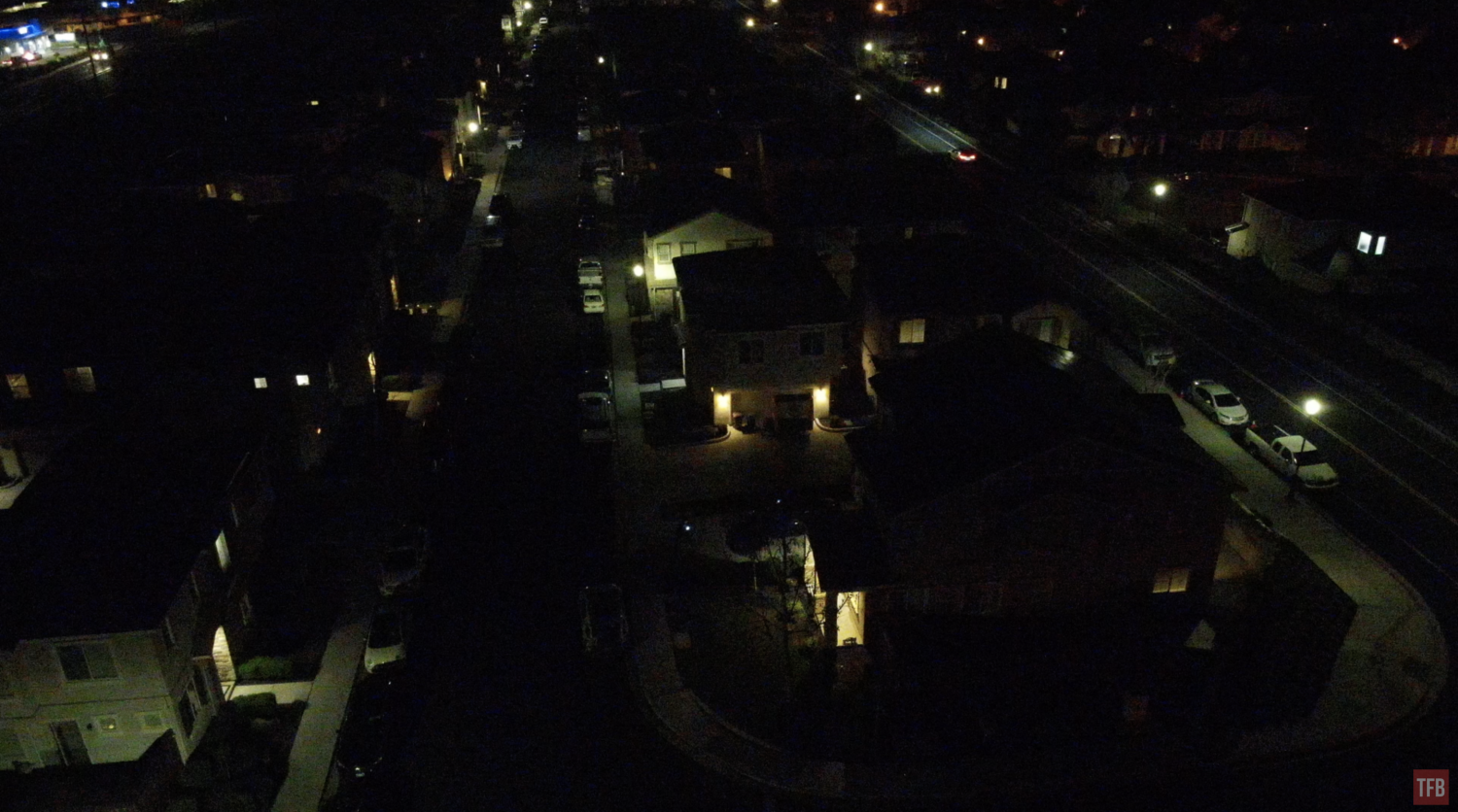
M2EA vis camera at night
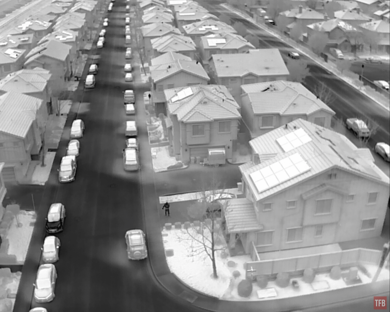
M2EA thermal camera at night
What a difference. With some editing, you can overlay the thermal image on top of the visual image.
Here are some video clips that came on another M2EA I helped acquire for a friend. The previous owner used it for hunting.
Tracking A vehicle with a thermal target test
At SHOT Show last January I got these sample thermal targets from infraredID. Here they are next to an old FLIR thermal target. They work by reflecting the sky which is cooler than your target.
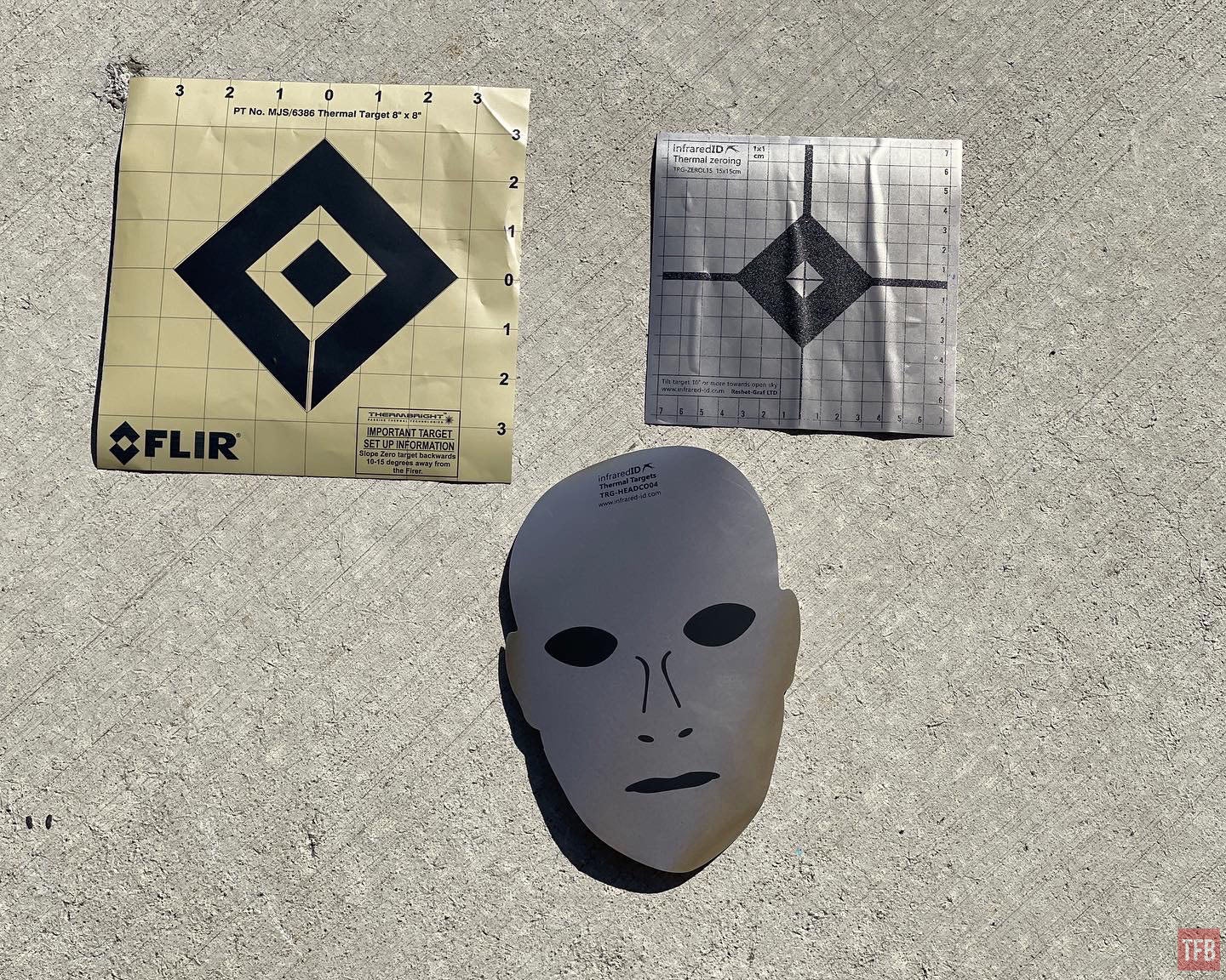
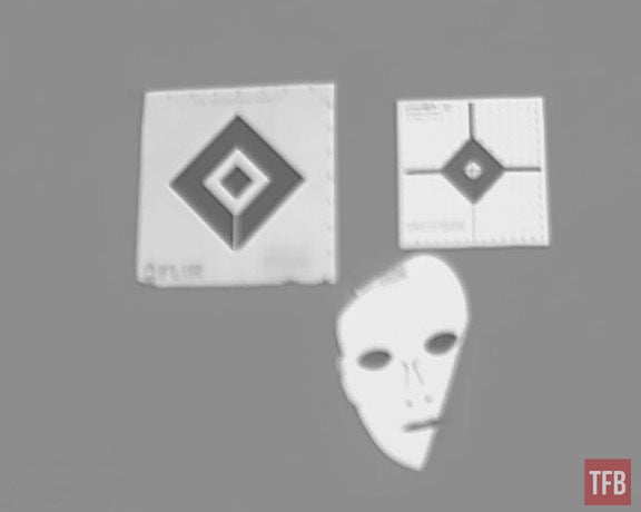
Thermal targets as seen by my AGM TM384 Micro thermal monocular.
I took the square target and placed it on the hood of my FJ Cruiser. Sure enough, the M2EA could easily see this 6″x6″ square.
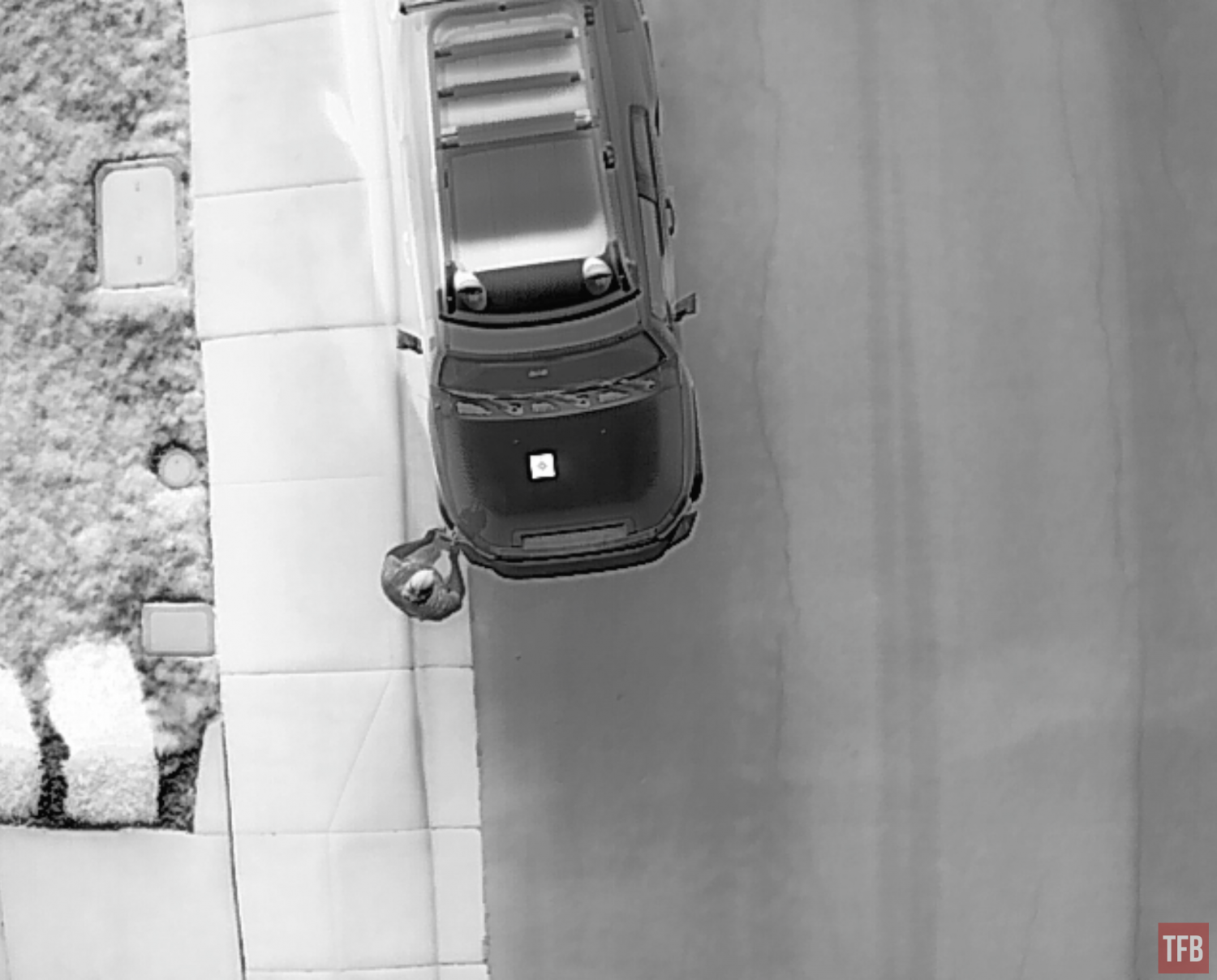
Even at 100 yards above, you can still see the small thermal square. This would be easier with a larger thermal reflective sheet but it would be relatively easy to mark a vehicle to track it with the M2EA.
If you read my review of the BAE/Trijicon UTCXII, I had a video showing what looked like a cow 2k yards away. To confirm this, I sent my M2EA drone to look at the cow. I discovered there was a whole herd of cows on the other side of a hill.
Final Thoughts On The Mavic 2 Enterprise Advanced
The Mavic 2 Enterprise Advanced is the best option for an affordable thermal drone. They retail for $6,500. While that seems like a lot, the next best solution is $7k and up. As you can see from the footage I captured, the thermal sensor on the drone is very good. Good enough to fly at night without crashing and have the ability to identify objects of interest. The only downside is that you need to get close to something to really discern what it is and the digital zoom is not that great for the thermal.
I would like to connect a laser designator to help point out targets of interest but there are complications. Often I found myself flying but not really knowing where I was in relation to the image I saw on the screen. Especially if I was looking for a specific location or point of interest. For example, there was a coyote that we saw with the UTCXII that was 730 yards away. It would be great to fly a drone there to confirm without manually flying it. But also if I spot something with the drone how do I relay that information back to a hunter? I could use the GPS coordinates of the drone but that is not quick or easy.
Allegedly, the Mavic 2 Enterprise Advanced can connect to ATAK. At the same time, you can have a laser range finder connected to ATAK. Perhaps you can designate a target with the laser and have the drone take that information and fly to the location you designated by GPS location? Imagine a hunter tags a possible target, but to confirm a positive ID you could send the drone to verify. This is all theoretical and something I will investigate further with my friends who have the tools to possibly make this happen. Stay tuned. For more information on the Mavic 2 Enterprise Advanced, check out DJI’s website.